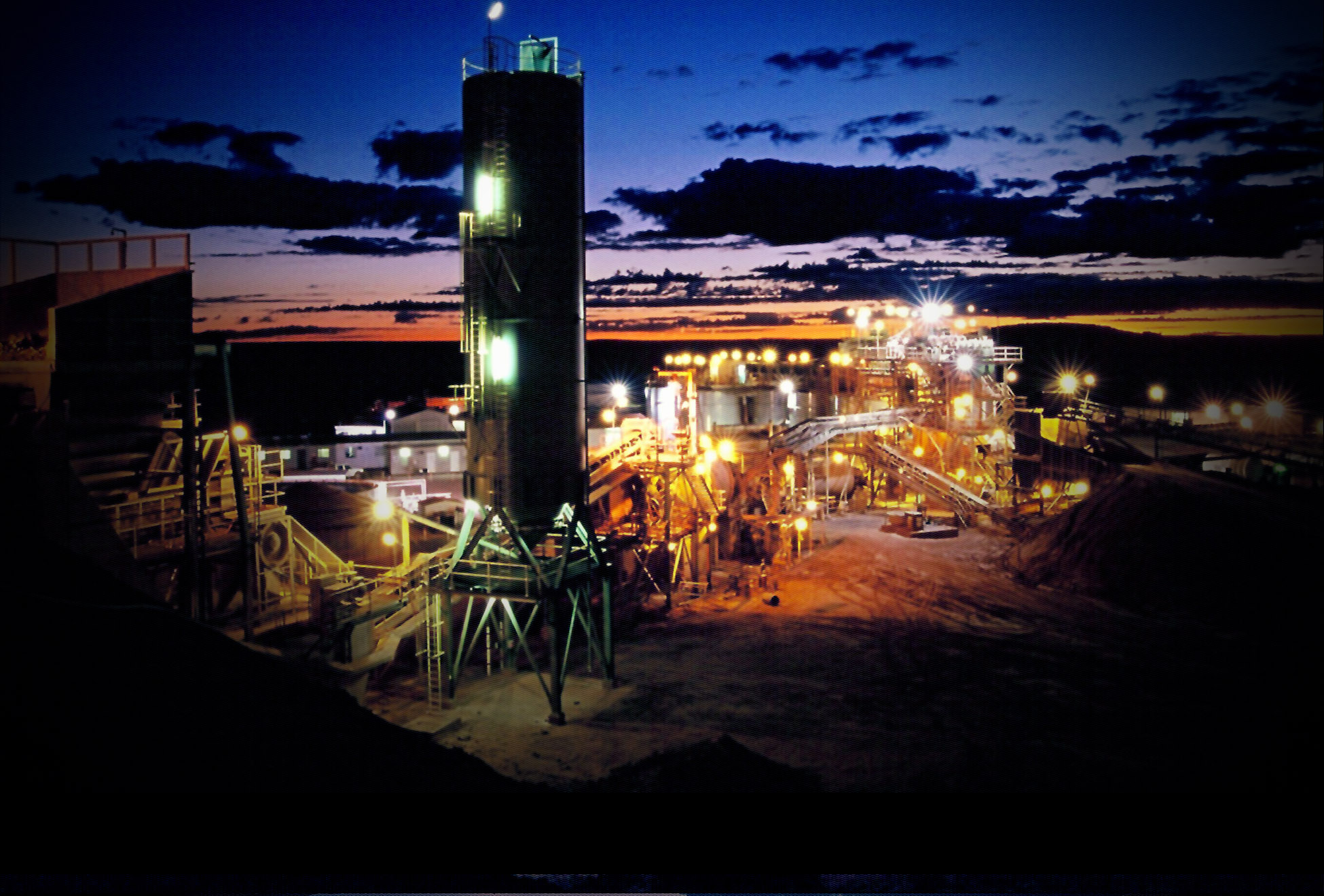

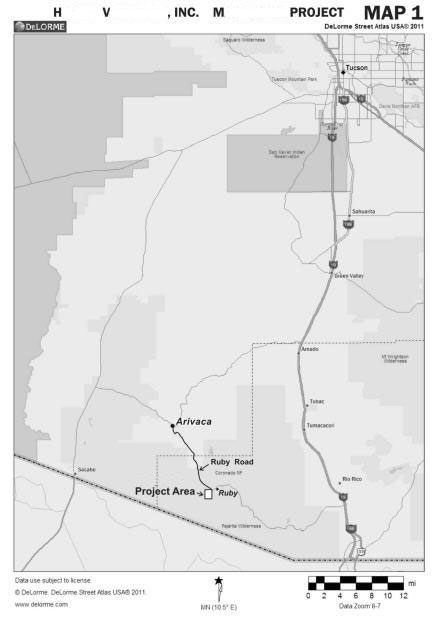
OWNED ASSET: The Oro Gold Mine 75 Miles SW of Tucson Arizona
 UPDATE: Goodmark Capital Group, Inc. (2017): Click on link below to see Assay and gravity concentration test of our now claimed Oro Gold Mine extended areas. (click on link and friend us on facebkook to see our latest project development photos)–> GoodMark Capital Group, Inc. has now claimed up 108 Claims total including our origional Oro Gold Mine and newly acquired extended area plus our Sulfide Claims to the north (Previously Known As The Idaho Mine Group) and The Choctaw Mine. (NEW TOTAL CLAIMS ACERAGE IS AS FOLLOWS: 2,189.96+15.75+18.06=2,22
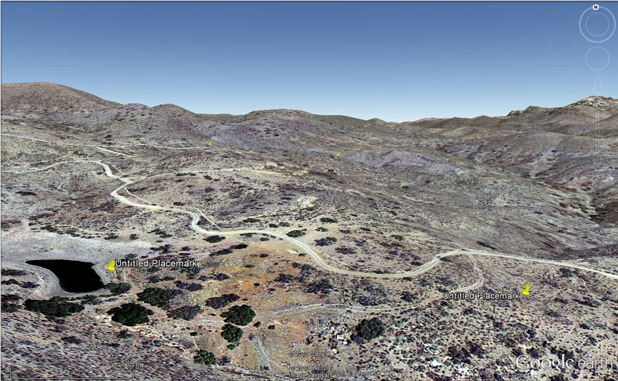
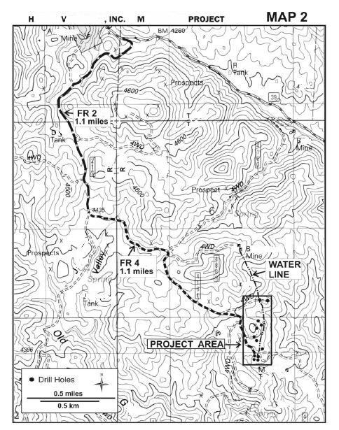
Click on the links below to show our test results, new claim information, location maps and photographs etc. 1. Assay Report to Mark-1 5-27-17-r , 2. Platt Maps For Claims, 3. Numbered Claim Block Diagram , 4. Topographical Claim Block Map , 5. Our First Mill , 6. Collage
MINE SITE 1: GoodMark Capital Group, Inc. has 108 claims Total in our Oro Gold Mine, Sulfide Gold Mine And Choctaw Gold Mine in southern Arizona. We hold the mineral rights to 2,22
($100M +/- gold reserves rotary drill core sample verified; sample procedures were followed that meet the requirements for NI 43-101 reporting; audit assayed; volumetric calculation; 5-7 year extraction life-rectangular box indicating test area shown on map below only), ($135-$404M+/- mineral reserve; rotary drill and percussion core sampled; USBM tested; probable volumetric calculation – Per Dekalb Mining Inc.'s reserve calculation in 1982.) see footnote ¹
Projection shown below indicates the value of the mine that is expected from recalculation on the original claim area of only the partial section of our whole claim that has had up to 400 ft deep drill core verification performed on it (See yellow claim block area only indicated in the news and updates section of our website) per Dekalb Mining Inc.'s minable reserves calculation in 1982 when factoring the (0.37) Ounces Per ton of Gold / OPT AU shown in later drill core verification program's audit assay). see footnote ¹
OPT AU shown in later deep drill core verification programs: (0.37 OPT AU)
Reserve tons estimate Per Dekalb Mining Inc (1982): 2,500,000 to 7,500,000 raw ore material.
Corrected Reserves Ounces Estimate at (0.37 OPT AU) = 925,000 to 2,775,000 ounces of gold.
Net per oz after extraction costs estimate: $900.00
Low / High value per Dekalb’s mineable ore material reserves estimate = $832,500,000.00 / $2,497,500,000.00
(Gold only – not including our new 60 additional claim block)
footnote ¹: (See: Page 10 GoodMark Prospectus Brochure 9314r) “4. Dekalb Mining Inc. (1982): Surface sampling program and their study of the distribution of silicified zones showed their estimated possible and potential reserves tonnage to be 2.5 to 7.5 million tons equaling 150,000 to 450.000 oz. gold.” Referenced from Page 24 section 6.5 of 80 page total “Report On ORO GOLD PROJECT” dated November 15, 2004 by J.H. Montgomery Professional Qualified Person, PH.D, P.Eng.
ADDITIONAL DRILL PROGRAM CONTRACTING AND TESTING HISTORY
1. Pittsburg Glass Industries-PPG (1976): 29 air-track holes to ranging in depths of 75 to 100 feet showed values up to 0.24 oz./ton gold.
2. Apache International Mining G.S.A. Resources (1980-85): 32 hole air-track drilling program totaling 2360 feet reported a calculated reserve of 220,000 tons equaling 13,200 oz. gold.
3. Homestake Mining Company (1982): A total of 353 rock samples tested showed values up to 0.13 oz./ton gold.
4. Dekalb Mining Inc. (1982): Surface sampling program and their study of the distribution of silicified zones showed their estimated possible and potential reserves tonnage to be 2.5 to 7.5 million tons equaling 150,000 to 450.000 oz. gold.
5. Studsvik Analytics AB (1982): 17 air-track drill holes totaling 1510 feet and 16 rotary drill holes totaling 3500 feet calculated reserves at 214,000 tons equaling 13,696 oz. gold including encountering gold values at depths of 230 and 390 feet associated within strongly fractured zones. This figure could be termed a drill-indicated resource.
6. Airborne Minerals Consultants International Inc. (1981-1984): Mr. Fred Brost, P.E. performed metallurgical tests on material from the mine in 1981 and 1984. On mine run material, recoveries of 37.8% gold and 26.35% silver were attained in a 14 day period. When crushed to -0.5 inches and agglomerated, recoveries were 92.46% for gold in 14 days.
7. Golden Concord Mining Corporation (1983): 40 air track holes drilled and from the results (Drill hole data is available for most off the holes but final reports were unavailable) they recommended an additional 155 air-track holes, 2000 feet of diamond drilling and metallurgical testing.
8. Amax Mining (1984): Using all available drill hole data, Amax made a reserve calculation of 516,000 tons equaling 27,864 oz. gold.
9. Sonora Exploration and Mining Co. (1984): In 1984 M.H. Johnson also made reserve estimates. He calculated a mineable reserve of 328,600 tons equaling 20,045 oz. gold.
10. Pirates Gold Corporation (1985): During 1985, a program of exploration was conducted for Pirates Gold Corporation by J.H. Montgomery, PH.D., P. Eng. Montgomery Consultants Ltd. For the purpose of a geostatistical reserve estimation a total of 233 drill holes were selected by G.H. Giroux, Ma. Sc., P. Eng. of Montgomery Consultants Ltd. showing 482,000 tons equaling 22,700 oz. gold reserve estimate. It is likely that the estimates would fall in the category of indicated mineral resources as set out in NI 43-101.
11. Newfields Minerals Inc. (1987-91): D. McKee prepared a Preliminary Feasibility study for Newfields Minerals Inc. estimating the cost of mining and processing at $10.45 per ton (1987). Steven Van Nort (1986) made an independent evaluation using the data from the study calculating a resource reserve estimate of 440,000 tons equaling 31,680 oz. gold.
12. La Teko Mines Ltd. – Now owned by Kinross 1991-96): Jeff Rogers of La Teko completed a total of 14 holes totaling 4000 feet of reverse circulating drilling to a maximum depth of 400 feet with a recommendation of additional mapping, sampling and data compilation based on a estimated potential of 2.3 million tons.
13. Rock Resources (2001-2002): Rock Resources geological team completed a VLF EM (very low frequency electro magnetic) survey over the grid to a chargeability depth of 200 ft. The Company hired Peter E. Wolcott & Associates Limited to perform a 16 km (10 mile) Induced Polarization Survey (IP) over the surveyed area in August 2002 to test for steep dipping quartz filled structures hosting vein gold mineralization.